

Case Study: How does Japan live with earthquakes?
Japan lies within one of the most tectonically active zones in the world. It experiences over 400 earthquakes every day. The majority of these are not felt by humans and are only detected by instruments. Japan has been hit by a number of high-intensity earthquakes in the past. Since 2000 there are have been 16000 fatalities as the result of tectonic activity.
Japan is located on the Pacific Ring of Fire, where the North American, Pacific, Eurasian and Philippine plates come together. Northern Japan is on top of the western tip of the North American plate. Southern Japan sits mostly above the Eurasian plate. This leads to the formation of volcanoes such as Mount Unzen and Mount Fuji. Movements along these plate boundaries also present the risk of tsunamis to the island nation. The Pacific Coastal zone, on the east coast of Japan, is particularly vulnerable as it is very densely populated.
The 2011 Japan Earthquake: Tōhoku
Japan experienced one of its largest seismic events on March 11 2011. A magnitude 9.0 earthquake occurred 70km off the coast of the northern island of Honshu where the Pacific and North American plate meet. It is the largest recorded earthquake to hit Japan and is in the top five in the world since records began in 1900. The earthquake lasted for six minutes.
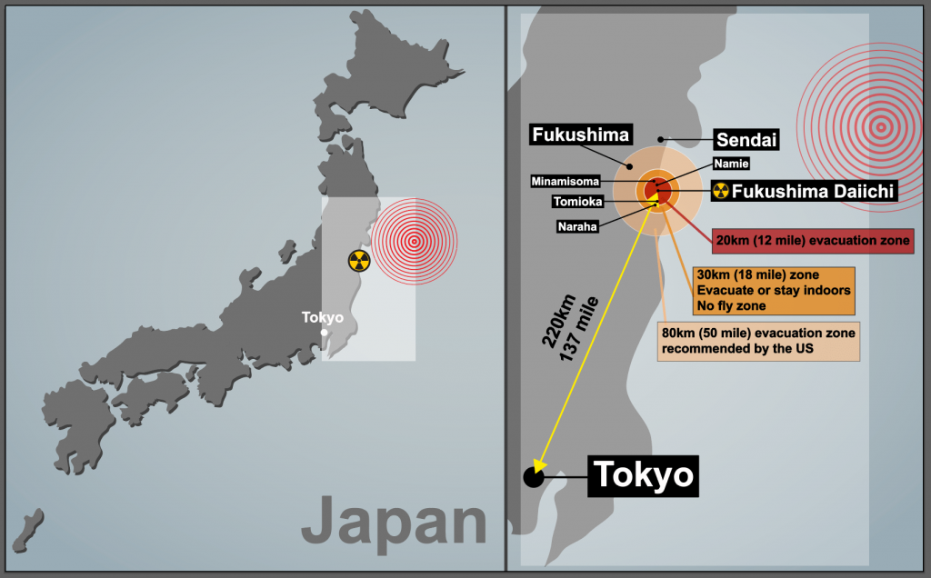
A map to show the location of the 2011 Japan Earthquake
The earthquake had a significant impact on the area. The force of the megathrust earthquake caused the island of Honshu to move east 2.4m. Parts of the Japanese coastline dr[[ed by 60cm. The seabed close to the focus of the earthquake rose by 7m and moved westwards between 40-50m. In addition to this, the earthquake shifted the Earth 10-15cm on its axis.
The earthquake triggered a tsunami which reached heights of 40m when it reached the coast. The tsunami wave reached 10km inland in some places.
What were the social impacts of the Japanese earthquake in 2011?
The tsunami in 2011 claimed the lives of 15,853 people and injured 6023. The majority of the victims were over the age of 60 (66%). 90% of the deaths was caused by drowning. The remaining 10% died as the result of being crushed in buildings or being burnt. 3282 people were reported missing, presumed dead.
Disposing of dead bodies proved to be very challenging because of the destruction to crematoriums, morgues and the power infrastructure. As the result of this many bodies were buried in mass graves to reduce the risk of disease spreading.
Many people were displaced as the result of the tsunami. According to Save the Children 100,000 children were separated from their families. The main reason for this was that children were at school when the earthquake struck. In one elementary school, 74 of 108 students and 10 out of 13 staff lost their lives.
More than 333000 people had to live in temporary accommodation. National Police Agency of Japan figures shows almost 300,000 buildings were destroyed and a further one million damaged, either by the quake, tsunami or resulting fires. Almost 4,000 roads, 78 bridges and 29 railways were also affected. Reconstruction is still taking place today. Some communities have had to be relocated from their original settlements.
What were the economic impacts of the Japanese earthquake in 2011?
The estimated cost of the earthquake, including reconstruction, is £181 billion. Japanese authorities estimate 25 million tonnes of debris were generated in the three worst-affected prefectures (counties). This is significantly more than the amount of debris created during the 2010 Haiti earthquake. 47,700 buildings were destroyed and 143,300 were damaged. 230,000 vehicles were destroyed or damaged. Four ports were destroyed and a further 11 were affected in the northeast of Japan.
There was a significant impact on power supplies in Japan. 4.4 million households and businesses lost electricity. 11 nuclear reactors were shut down when the earthquake occurred. The Fukushima Daiichi nuclear power plant was decommissioned because all six of its reactors were severely damaged. Seawater disabled the plant’s cooling systems which caused the reactor cores to meltdown, leading to the release of radioactivity. Radioactive material continues to be released by the plant and vegetation and soil within the 30km evacuation zone is contaminated. Power cuts continued for several weeks after the earthquake and tsunami. Often, these lasted between 3-4 hours at a time. The earthquake also had a negative impact on the oil industry as two refineries were set on fire during the earthquake.
Transport was also negatively affected by the earthquake. Twenty-three train stations were swept away and others experienced damage. Many road bridges were damaged or destroyed.
Agriculture was affected as salt water contaminated soil and made it impossible to grow crops.
The stock market crashed and had a negative impact on companies such as Sony and Toyota as the cost of the earthquake was realised. Production was reduced due to power cuts and assembly of goods, such as cars overseas, were affected by the disruption in the supply of parts from Japan.
What were the political impacts of the Japanese earthquake in 2011?
Government debt was increased when it injects billions of yen into the economy. This was at a time when the government were attempting to reduce the national debt.
Several years before the disaster warnings had been made about the poor defences that existed at nuclear power plants in the event of a tsunami. A number of executives at the Fukushima power plant resigned in the aftermath of the disaster. A movement against nuclear power, which Japan heavily relies on, developed following the tsunami.
The disaster at Fukushima added political weight in European countries were anti-nuclear bodies used the event to reinforce their arguments against nuclear power.
Privacy Overview
Pin it on pinterest.
You must be logged in to post a comment.
- 0 Shopping Cart

Japan Earthquake 2011
Japan earthquake 2011 case study.
An earthquake measuring 9.0 on the Richter Scale struck off Japan’s northeast coast, about 250 miles (400km) from Tokyo at a depth of 20 miles.
The magnitude 9.0 earthquake happened at 2:46 pm (local time) on Friday, March 11, 2011.
The earthquake occurred 250 miles off the North East Coast of Japan’s main island Honshu.
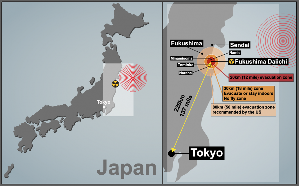
Japan 2011 Earthquake map
Japan is located on the eastern edge of the Eurasian Plate. The Eurasian plate, which is continental, is subducted by the Pacific Plate, an oceanic plate forming a subduction zone to the east of Japan. This type of plate margin is known as a destructive plate margin . The process of subduction is not smooth. Friction causes the Pacific Plate to stick. Pressure builds and is released as an earthquake.
Friction has built up over time, and when released, this caused a massive ‘megathrust’ earthquake.
The amount of energy released in this single earthquake was 600 million times the energy of the Hiroshima nuclear bomb.
Scientists drilled into the subduction zone soon after the earthquake and discovered a thin, slippery clay layer lining the fault. The researchers think this clay layer allowed the two plates to slide an incredible distance, some 164 feet (50 metres), facilitating the enormous earthquake and tsunami .
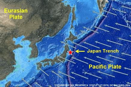
2011 Japan Earthquake Map
The earthquake occurred at a relatively shallow depth of 20 miles below the surface of the Pacific Ocean. This, combined with the high magnitude, caused a tsunami (find out more about how a tsunami is formed on the BBC website).
Areas affected by the 2011 Japanese earthquake.
What were the primary effects of the 2011 Japan earthquake?
Impacts on people
Death and injury – Some 15,894 people died, and 26,152 people were injured. 130,927 people were displaced, and 2,562 remain missing.
Damage – 332,395 buildings, 2,126 roads, 56 bridges and 26 railways were destroyed or damaged. 300 hospitals were damaged, and 11 were destroyed.
Blackouts – Over 4.4 million households were left without electricity in North-East Japan.
Transport – Japan’s transport network suffered huge disruptions.
Impacts on the environment
Landfall – some coastal areas experienced land subsidence as the earthquake dropped the beachfront in some places by more than 50 cm.
Land movement – due to tectonic shift, the quake moved parts of North East Japan 2.4 m closer to North America.
Plate shifts – It has been estimated by geologists that the Pacific plate has slipped westwards by between 20 and 40 m.
Seabed shift – The seabed near the epicentre shifted by 24 m, and the seabed off the coast of the Miyagi province has moved by 3 m.
Earth axis moves – The earthquake moved the earth’s axis between 10 and 25 cm, shortening the day by 1.8 microseconds.
Liquefaction occurred in many of the parts of Tokyo built on reclaimed land. 1,046 buildings were damaged
What were the secondary effects of the 2011 Japan earthquake?
Economy – The earthquake was the most expensive natural disaster in history, with an economic cost of US$235 billion.
Tsunami – Waves up to 40 m in high devastated entire coastal areas and resulted in the loss of thousands of lives. This caused a lot of damage and pollution up to 6 miles inland. The tsunami warnings in coastal areas were only followed by 58% who headed for higher ground. The wave hit 49% of those not following the warning.
Nuclear power – Seven reactors at the Fukushima nuclear power station experienced a meltdown. Levels of radiation were over eight times the normal levels.
Transport – Rural areas remained isolated for a long time because the tsunami destroyed major roads and local trains and buses. Sections of the Tohoku Expressway were damaged. Railway lines were damaged, and some trains were derailed.
Aftermath – The ‘Japan move forward committee’ thought that young adults and teenagers could help rebuild parts of Japan devastated by the earthquake.
Coastal changes – The tsunami was able to travel further inland due to a 250-mile stretch of coastline dropping by 0.6 m.
What were the immediate responses to the Japan 2011 earthquake?
- The Japan Meteorological Agency issued tsunami warnings three minutes after the earthquake.
- Scientists had been able to predict where the tsunami would hit after the earthquake using modelling and forecasting technology so that responses could be directed to the appropriate areas.
- Rescue workers and around 100,000 members of the Japan Self-Defence Force were dispatched to help with search and rescue operations within hours of the tsunami hitting the coast.
- Although many search and rescue teams focused on recovering bodies washing up on shore following the tsunami, some people were rescued from under the rubble with the help of sniffer dogs.
- The government declared a 20 km evacuation zone around the Fukushima nuclear power plant to reduce the threat of radiation exposure to local residents.
- Japan received international help from the US military, and search and rescue teams were sent from New Zealand, India, South Korea, China and Australia.
- Access to the affected areas was restricted because many were covered in debris and mud following the tsunami, so it was difficult to provide immediate support in some areas.
- Hundreds of thousands of people who had lost their homes were evacuated to temporary shelters in schools and other public buildings or relocated to other areas.
- Many evacuees came from the exclusion zone surrounding the Fukushima nuclear power plant. After the Fukushima Daiichi nuclear meltdown, those in the area had their radiation levels checked, and their health monitored to ensure they did not receive dangerous exposure to radiation. Many evacuated from the area around the nuclear power plant were given iodine tablets to reduce the risk of radiation poisoning.
What were the long-term responses to the Japan 2011 earthquake?
- In April 2011, one month after the event occurred, the central government established the Reconstruction Policy Council to develop a national recovery and reconstruction outlook for tsunami-resilient communities. The Japanese government has approved a budget of 23 trillion yen (approximately £190 billion) to be spent over ten years. Central to the New Growth Strategy is creating a ‘Special Zones for Reconstruction’ system. These aim to provide incentives to attract investment, both in terms of business and reconstruction, into the Tohoku region.
- Also, the central government decided on a coastal protection policy, such as seawalls and breakwaters which would be designed to ensure their performance to a potential tsunami level of up to the approximately 150-year recurrence interval.
- In December 2011, the central government enacted the ‘Act on the Development of Tsunami-resilient Communities’. According to the principle that ‘Human life is most important, this law promotes the development of tsunami-resistant communities based on the concept of multiple defences, which combines infrastructure development and other measures targeting the largest class tsunami.
- Japan’s economic growth after the Second World War was the world’s envy. However, over the last 20 years, the economy has stagnated and been in and out of recession. The 11 March earthquake wiped 5–10% off the value of Japanese stock markets, and there has been global concern over Japan’s ability to recover from the disaster. The priority for Japan’s long-term response is to rebuild the infrastructure in the affected regions and restore and improve the economy’s health as a whole.
- By the 24th of March 2011, 375 km of the Tohoku Expressway (which links the region to Tokyo) was repaired and reopened.
- The runway at Sendai Airport had been badly damaged. However, it was restored and reusable by the 29th of March due to a joint effort by the Japanese Defence Force and the US Army.
- Other important areas of reconstruction include the energy, water supply and telecommunications infrastructure. As of November 2011, 96% of the electricity supply had been restored, 98% of the water supply and 99% of the landline network.
Why do people live in high-risk areas in Japan?
There are several reasons why people live in areas of Japan at risk of tectonic hazards:
- They have lived there all their lives, are close to family and friends and have an attachment to the area.
- The northeast has fertile farmland and rich fishing waters.
- There are good services, schools and hospitals.
- 75% of Japan is mountainous and flat land is mainly found in coastal areas, which puts pressure on living space.
- They are confident about their safety due to the protective measures that have been taken, such as the construction of tsunami walls.
Japan’s worst previous earthquake was of 8.3 magnitude and killed 143,000 people in Kanto in 1923. A magnitude 7.2 quake in Kobe killed 6,400 people in 1995 .

Premium Resources
Please support internet geography.
If you've found the resources on this page useful please consider making a secure donation via PayPal to support the development of the site. The site is self-funded and your support is really appreciated.
Related Topics
Use the images below to explore related GeoTopics.
Previous Topic Page
Topic home, next topic page, share this:.
- Click to share on Twitter (Opens in new window)
- Click to share on Facebook (Opens in new window)
- Click to share on Pinterest (Opens in new window)
- Click to email a link to a friend (Opens in new window)
- Click to share on WhatsApp (Opens in new window)
- Click to print (Opens in new window)
If you've found the resources on this site useful please consider making a secure donation via PayPal to support the development of the site. The site is self-funded and your support is really appreciated.
Search Internet Geography
Top posts and pages.
Latest Blog Entries
Pin It on Pinterest
- Click to share
- Print Friendly
HISTORIC ARTICLE
Mar 11, 2011 ce: tohoku earthquake and tsunami.
On March 11, 2011, Japan experienced the strongest earthquake in its recorded history.
Earth Science, Oceanography, Geography, Physical Geography
Loading ...
Learning materials.
- Click below to see a MapMaker Interactive map displaying tectonic activity surrounding the Tohoku earthquake and tsunami.
On March 11, 2011, Japan experienced the strongest earthquake in its recorded history. The earthquake struck below the North Pacific, 130 kilometers (81 miles) east of Sendai, the largest city in the Tohoku region , a northern part of the island of Honshu.
The Tohoku earthquake caused a tsunami . A tsunami—Japanese for “ harbor wave ”—is a series of powerful waves caused by the displacement of a large body of water. Most tsunamis, like the one that formed off Tohoku, are triggered by underwater tectonic activity , such as earthquakes and volcanic eruptions . The Tohoku tsunami produced waves up to 40 meters (132 feet) high, More than 450,000 people became homeless as a result of the tsunami. More than 15,500 people died. The tsunami also severely crippled the infrastructure of the country .
In addition to the thousands of destroyed homes, businesses, roads, and railways, the tsunami caused the meltdown of three nuclear reactors at the Fukushima Daiichi Nuclear Power Plant . The Fukushima nuclear disaster released toxic , radioactive materials into the environment and forced thousands of people to evacuate their homes and businesses.
Media Credits
The audio, illustrations, photos, and videos are credited beneath the media asset, except for promotional images, which generally link to another page that contains the media credit. The Rights Holder for media is the person or group credited.
Last Updated
October 19, 2023
User Permissions
For information on user permissions, please read our Terms of Service. If you have questions about how to cite anything on our website in your project or classroom presentation, please contact your teacher. They will best know the preferred format. When you reach out to them, you will need the page title, URL, and the date you accessed the resource.
If a media asset is downloadable, a download button appears in the corner of the media viewer. If no button appears, you cannot download or save the media.
Text on this page is printable and can be used according to our Terms of Service .
Interactives
Any interactives on this page can only be played while you are visiting our website. You cannot download interactives.
Related Resources

An official website of the United States government
Here's how you know
The .gov means it’s official. Federal government websites often end in .gov or .mil. Before sharing sensitive information, make sure you’re on a federal government site.
The site is secure. The https:// ensures that you are connecting to the official website and that any information you provide is encrypted and transmitted securely.
On This Day: 2011 Tohoku Earthquake and Tsunami
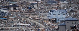
On March 11, 2011, a magnitude (Mw) 9.1 earthquake struck off the northeast coast of Honshu on the Japan Trench. A tsunami that was generated by the earthquake arrived at the coast within 30 minutes, overtopping seawalls and disabling three nuclear reactors within days. The 2011 Tohoku Earthquake and Tsunami event, often referred to as the Great East Japan earthquake and tsunami , resulted in over 18,000 dead, including several thousand victims who were never recovered.
The deadly earthquake was the largest magnitude ever recorded in Japan and the third-largest in the world since 1900.
How It Happened
The 2011 event resulted from thrust faulting on the subduction zone plate boundary between the Pacific and North America plates, according to the U.S. Geological Survey .
This region has a high rate of seismic activity, with the potential to generate tsunamis. Past earthquakes that generated tsunamis in the region have included the deadly events of 1611 , 1896 , and 1933 .
The March 11, 2011 earthquake generated a tsunami with a maximum wave height of almost 40 meters (130 feet) in the Iwate Prefecture . Researchers also determined that a 2,000-kilometer (1,242-mile) stretch of Japan’s Pacific coast was impacted by the tsunami.
Following the earthquake, a tsunami disabled the power supply and cooling of three Fukushima Daiichi reactors, causing a significant nuclear accident . All three nuclear cores largely melted in the first three days.
As of December 2020, the Japan National Police Agency reported 15,899 deaths, 2,527 missing and presumed deaths, and 6,157 injuries for the Great East Japan event.
In Japan, the event resulted in the total destruction of more than 123,000 houses and damage to almost a million more. Ninety-eight percent of the damage was attributed to the tsunami. The costs resulting from the earthquake and tsunami in Japan alone were estimated at $220 billion USD. The damage makes the 2011 Great East Japan earthquake and tsunami the most expensive natural disaster in history.
Although the majority of the tsunami’s impact was in Japan, the event was truly global. The tsunami was observed at coastal sea level gauges in over 25 Pacific Rim countries, in Antarctica, and on the west coast of the Atlantic Ocean in Brazil.
The tsunami caused $31 million USD damage in Hawaii and $100 million USD in damages and recovery to marine facilities in California. Additionally, damage was reported in French Polynesia, Galapagos Islands, Peru, and Chile.
Fortunately, the loss of life outside of Japan was minimal (one death in Indonesia and one death in California) due to the Pacific Tsunami Warning System and its connections to national-level warning and evacuation systems.
From Peril to Preparedness
To learn from the tragedy in Japan, researchers collected extensive data on tsunami wave forces and building performance. This facilitated improvement in tsunami mitigation strategies, such as building codes. Over 6,200 tsunami wave measurements were collected in Japan and the Pacific region.
Several thousands of lives across the world were lost to large, far-afield tsunamis prior to the establishment of the Pacific Tsunami Warning System in 1965. The Great East Japan earthquake and tsunami demonstrated that despite the severity of the natural hazard the investment in the warning system has been a success.
Japan is often considered the country most prepared for tsunamis but still lost numerous lives in this event. Nonetheless, experts believe many lives were saved in Japan and elsewhere due to the existing warning and mitigation systems.
An effective tsunami warning system relies on the free and open exchange and long-term management of global data and science products to mitigate, model, and forecast tsunamis. NCEI is the global data and information service for tsunamis. Global historical tsunami data, including more information about the Great East Japan earthquake and tsunami, are available via interactive maps and a variety of web services.
For more information on how you can prepare for a tsunami, visit the National Tsunami Hazard Mitigation Program . Also, visit NCEI’s Natural Hazards website for more earthquake and tsunami data, images, and educational materials.
Kong, L., P. Dunbar, and N. Arcos (2015). Pacific Tsunami Warning System: A Half-Century of Protecting the Pacific 1965-2015. Honolulu: International Tsunami Information Center.
Satake, K. (2014). Chapter 24, The 2011 Tohoku, Japan, Earthquake and Tsunami. Extreme Natural Hazards, Disaster Risks and Societal Implications, Cambridge University Press, p. 340-351.
UNESCO/IOC (2012). Summary Statement from the Japan - UNESCO - UNU Symposium on The Great East Japan Tsunami on 11 March 2011 and Tsunami Warning Systems: Policy Perspectives 16 - 17 February 2012
Broken links updated.
Related Links
Article tags, related news.
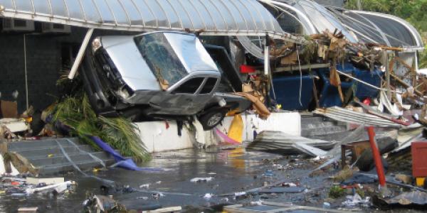
August 25, 2023
On This Day: 2009 Samoa Islands Tsunami
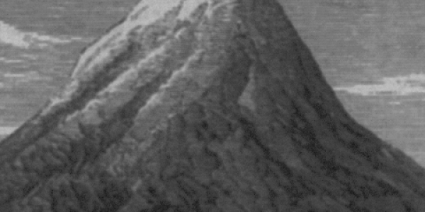
August 16, 2023
On This Day: Historic Krakatau Eruption of 1883
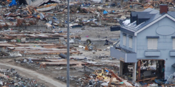
March 3, 2023

A new NSF CAREER award project aims to improve understanding of Oregon’s inland faults
Geology professor Ashley Streig receives $580K grant to study the rotation of landmasses in Oregon and the faults responsible for their movement.
by Shaun McGillis February 7th 2022 Share

When we talk about earthquakes in the Pacific Northwest, the discussion is almost always about the inevitable "big one"--a magnitude nine or greater Cascadia subduction zone earthquake. The last time such an earthquake struck was 322 years ago, a long enough time for some geologists to put the odds of a big Cascadia quake occurring in the next fifty years at three to one.
Portland State University earthquake geologist, Ashely Streig, knows firsthand the kind of damage earthquakes can cause. Streig has served on several teams responding to major seismic events--the Chi-Chi earthquake, which struck Taiwan in 1999, and the 2011 Tohoku subduction zone earthquake and tsunami in Japan. Today, Streig's research focuses on the potential for significant seismicity after the rupture of the Cascadia subduction zone, not the shaking of aftershocks, but earthquakes originating from inland faults here in Oregon.
Streig recently received a five-year, $582,316 CAREER award from the National Science Foundation (NSF) to study some of these inland crustal faults in western Oregon, the northern Oregon Cascades, and the Strawberry Range in the eastern part of the state.
According to Streig, geologic forces are causing the landmass of the Pacific Northwest to rotate in a clockwise orientation relative to the rest of the North American continent. Over the past few decades, geologists have developed models that simulate this crustal deformation using GPS data. The models show landmasses moving between two and seven millimeters per year, depending on location in the state. Geologists presume fault systems bounding these blocks of landmasses are responsible for the movement. However, not all boundaries coincide with known faults, and faults can be difficult to identify using GPS data because of the relatively sparse instrumentation and short period of data collection. Furthermore, features such as dense vegetation can obscure what geologists can observe in the field.
Streig's study aims to improve seismic hazard models and maps used by agencies such as the U.S. Geological Survey and enhance our overall understanding of crustal deformation in Oregon. To do so, Streig and her research team will determine how these inland faults work together to accommodate the clockwise rotation.
"We don't have a lot of data on these faults and their relation to plate boundary motion," Streig said. "We only have about twenty years of GPS data, which isn't adequate if we want high-quality models. Additionally, we're in this period between subduction zone earthquakes, so the stress caused by the Juan de Fuca plate sinking beneath the North American plate is clamping down all these crustal faults. That could mean the faults are primed for activity if a subduction zone earthquake released that stress."
Such was the case after the Tohoku subduction zone earthquake when, one month later, similar crustal faults activated and unleashed destructive energy across the region. The potential for such seismic events here in Oregon is why understanding the Pacific Northwest's network of inland faults and their relationship to the rotation of landmasses is essential to preparing for future quakes and the risks associated with their seismicity.
Streig's approach to improving understanding of the network of inland crustal faults and landmass deformation in Oregon involves searching for unidentified fault structures along the boundaries of landmasses where deformation is occurring and conducting fieldwork to assess the timing of recent seismic activity along several faults.
To identify previously unknown fault structures along the boundaries of rotating landmasses--those that have generated surface rupturing earthquakes in recent geologic history, Streig and the research team will analyze Lidar (light detection and ranging) datasets. The advantage of Lidar, Streig noted, is the quality of the resolution it provides, allowing researchers to strip away vegetation and examine surface features in one- to two-meter units to identify characteristics associated with faults. Dating recent seismic activity along some of the faults will take the research team out into the field. There they'll collect samples of deposits of organic matter for carbon dating. That dating can provide clues as to when the site was last seismically active. In locations such as glacial moraines that lack organic material to date, the team will collect rock samples for a process of isotopic analysis. That analysis, along with the measurement of features of the fault structures, will allow the team to calculate when the last seismic activity occurred.
"You can think of these faults and the landmasses they constrain and move as kind of a patchwork quilt," Streig said. "The Lidar data will help us see pieces we didn't know were there and how everything fits together. Then we can combine that spatial data with the temporal data. Once we've done that, we can start to understand how the pieces move over time--how the crust is deforming and how the faults work together to accommodate the rotation of the land."
In addition to funding the science, the CAREER award supports graduate students and paid internships for undergraduate students that Streig plans to recruit from PSU's NSF-funded Louis Stokes Alliance for Minority Participation program. Streig notes that geology is one of the most underrepresented STEM fields. A project of this scope and duration provides an excellent opportunity for women and members of the BIPOC community to engage in earthquake geology. Streig also plans to partner with the Oregon Museum of Science and Industry (OMSI) in Portland via the OMSI Science Communications Fellowship program. The partnership will result in creating an interactive demonstration exhibit at the museum to educate the public about earthquake geology in the Pacific Northwest.
Related Links:
- Ashley Streig
Things you buy through our links may earn Vox Media a commission.
- Earthquake and Aftershock Shake New York City: Live Updates
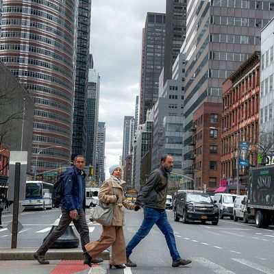
A 4.8 magnitude earthquake shook New Jersey and New York City on Friday morning, followed by a 4.0 magnitude aftershock in the evening — surprising and confusing area residents not used to seismic phenomena. Below are the latest updates and everything we know about the quake, aftershock, and aftermath.

Only in New York
Our emergency alerts may lag, but no other city can out-hustle this one:
Could there be additional powerful aftershocks?
Earthquake Insights’ Dr. Judith Hubbard and Dr. Kyle Bradley explained the possible aftershocks in their detailed analysis of the East Coast quake:
As with all earthquakes, this event will trigger some aftershocks. Aftershocks are simply earthquakes that occur after other earthquakes, and are therefore thought to be related to stress changes caused by the first event. Most aftershocks will be small - many of them too small to feel. As of this post, six events smaller than magnitude 2.5 have already been detected. Based on records from past events, the USGS has developed an aftershock forecast. This forecast shows that aftershocks of at least magnitude 3 are likely; magnitude 4+ events are also possible (30% chance over the next year). It is possible, but not likely, that this earthquake could trigger an event above magnitude 5. If that happened, that event would renamed the mainshock, and the M4.8 would be described as a foreshock.
And per USGS research structural engineer Kishor S. Jaiswal, in a comment to the New York Times :
The aftershocks will likely “continue for several days and even a week,” he said Friday evening. There is also a small chance that an earthquake of similar or even larger magnitude could occur during such a sequence, he said.
A sizable evening aftershock!
The aftershock, registering a preliminary 4.0 magnitude , happened at 5:59 p.m. with an epicenter a little over 4 miles southwest of Gladstone, New Jersey. It was not the first aftershock, but the first one widely felt in the area since the more powerful first quake in the series on Friday morning.
Remember the pets
Animals don’t love earthquakes .
A few homes suffered structural damage in Newark
But there were no injuries. WABC reports :
Three multifamily homes have been evacuated by the city of Newark following Friday’s earthquake. There’s some roof damage. One house apparently shifted during the earthquake and is now leaning on the house next door. The homes are located near the intersection of 7th Avenue and 3rd Street. Shortly after the earthquake at 10:23 a.m. on Friday , the city received a 911 call to report structural damage. When firefighters arrived, they evacuated all three buildings. Ten families are displaced — a total of 25 people, including 3 children.
In case you were wondering how well New York’s older buildings would fair against a stronger quake
Aaron Short spoke with a structural engineer Troy Morgan , who says we shouldn’t bet on the safety of brick:
Which city buildings are the least equipped for an earthquake? Generally, unreinforced masonry or brick buildings because they’re heavy and they lack steel reinforcement. Things that are heavy experience more force, and if they don’t have enough steel reinforcement to resist those forces, they can be susceptible to damage. There are a lot of brick buildings in New York, New Jersey, and Connecticut, and those are buildings you’d expect to see cracking to develop or damage to their foundations. You can get shaking if there’s a large enough quake, and you can get liquefaction, where the soil temporarily liquifies, and you can get settlement that results from that.
Read the rest of the interview here .
A 1995 New York cover story , which we’ve republished for the first time today, examined how well the city would hold up against an earthquake. It begins:
More than 80 people were interviewed for this piece. They came from many different disciplines. They had wildly competitive agendas. But there was one thing they all agreed on: It’s coming. They disagreed on how big, how devastating, how soon. But this, no one denies — we’re going to see an earthquake. In New York City. And we’re not ready for it.
Read the rest of that story here .
Sorry earth science conspiracy theorists, the earthquake is probably not linked to the total eclipse
Experts, if you believe in experts, tell the New York Times there’s scant evidence the two rare events could be related:
Earthquakes happen along fault lines, or cracks between two blocks of rock on Earth’s crust. Tides stretch and squish the land on Earth just as they contribute to waves in the ocean, and those tidal forces grow as the sun, moon and Earth begin to align — a configuration that sometimes creates a solar eclipse. One theory is that this may introduce additional stress along Earth’s fault lines. “We do know that the relative position of the Earth and the moon and the sun does exert tidal forces,” said William Frank, a geophysicist at the Massachusetts Institute of Technology. “And we know that changes the stress that can be on a fault that can host an earthquake.” But the results of several studies of the relationship between earthquakes and tides are inconclusive, according to Seth Stein, a geophysicist at Northwestern University. “If there’s any effect, it would be incredibly weak,” he said.
But the Florida woman who believes in Jewish space lasers has her own theory

Good thing this wasn’t the big one
I just wrote about the flat-footed response from city and state officials in the immediate aftermath of the quake:
An emergency alert from the city didn’t hit phones for a full half hour after the shaking stopped. A second alert followed about 45 minutes later. An alert from the state would go out nearly a full hour after the quake had subsided, though Governor Kathy Hochul issued a statement shortly after the tremors. When asked about the gap in between when the earthquake was registered to when city residents were alerted, the city’s emergency manager Zach Iscol said the time was actually fast by their standards.
The East Coast earthquake’s music video
There was an aftershock, but it seems to have gone unfelt.
A 2.0 magnitude aftershock was detected near Bedminster, New Jersey, at 12:20 p.m., according to the USGS. While some have reported it “rocked” Donald Trump’s Bedminster golf club, there’s no evidence anybody even felt the second, much smaller tremor.
Still no reports of significant damage
Per Gothamist :
New York City Emergency Management said it hadn’t received reports of any damage to infrastructure shortly after the tremor shook the five boroughs and surrounding area. City infrastructure and services continued to operate following the rare quake. New York City’s public schools had no reports of damage as of about 11 a..m, according to school system spokesperson Nathaniel Styer . The Port Authority of New York and New Jersey reopened the Holland Tunnel following a short delay at about 11:15 a.m. In New Jersey, the state’s Board of Public Utilities said gas and electric infrastructure appeared to be undamaged. “No impacts or damage to utility infrastructure or the grid resulting from the earthquake have been reported at this time,” the board wrote on X just before noon. Inspectors, architects and construction site managers who spoke with Gothamist on Friday morning said they had not received reports of damages or disruption.
What’s it’s like to get a vasectomy during an earthquake
Wired interviews Justin Allen , who had the misfortune of being in a very delicate situation during Friday morning’s tremor:
At what stage of the procedure did this happen? We were probably almost at the midway point. Essentially, the procedure started around 10:10 [am ET] and it was 10:24 or 10:25 that the earthquake hit. Could you, uh, paint the picture for me of what it was like on that table? I’m laying there. He’s in the middle of whatever he needs to do down there and the whole building started shaking. I wasn’t sure what was happening. It definitely felt like an earthquake, but we don’t normally have those. I didn’t know if there was a train nearby or something that would cause the building to shake. And then the doctor was like, “Oh my, God. That’s an earthquake.” I thought he was messing with me. I thought it was just him trying to be funny. But as this was happening, the desk staff outside the room started screaming about an earthquake and I was like “Oh, wow this is really happening.” And the doctor puts the tools down and asks, “How long does an earthquake normally last?” and the nurse said, “I think about a minute or two.” So we stopped and waited, and he resumed as soon as it was done. So he stopped right as the shaking happened? I think so. He was toward the end of whatever step he was doing right then and there. But he did set the tools down for a moment to recalibrate.
How the earthquake looked at the U.N.
Seems like the shaking lasted about 40 seconds:
Mayor Adams says no indication of infrastructure damage or injuries
Mayor Eric Adams and other city officials held a briefing shortly after noon following the earthquake that unsettled the metro area. He said that he’s been in touch with both the White House and Governor Hochul’s office but that the quake appears to have had minimal impact on the city.
“At this point, we do not have any reports of major impacts to our infrastructure or injuries, but, of course, we’re still assessing the situation and will continue to update the public,” he said.
NYC Emergency Management Commissioner Zach Iscol said that the likelihood of aftershocks is “low” but advised residents to be attentive in the coming days. “We do remain vigilant and we ask all New Yorkers to remain vigilant as well,” he said.
Hochul: No major damage reported yet
In a briefing just before noon, Governor Kathy Hochul told reporters that the state hadn’t felt a quake of this magnitude since 2011, when the effects of a 5.8 earthquake that struck Virginia could be felt as far away as Buffalo. “This is one of the largest earthquakes on the East Coast to occur in the last century,” she said.
The governor announced that structural and engineering teams are surveying bridges and roads as well as transmission lines and dams for any impact from the earthquake, but so far nothing has been reported. Hochul also advised residents to inspect their own properties for any damage and to stay alert in case of any aftershocks.
“If there is an after effect, please stay away from buildings, especially our high-rises. If you hear a shifting or any noises, unusual noises, leave your home. Go outside. You’re safer there than in a building that could be crumbling around you,” she said.
Hochul noted that she was meeting with her senior team about the ongoing budget negotiations when the earthquake hit. “Getting a budget done that includes a once in a lifetime housing package may be the only seismic event we expected this week. So this was rather unanticipated,” she said.
Seriously though, are the End Times nigh?
Our official Rapture correspondent, Sarah Jones, asks :
We had floods earlier this week. A solar eclipse is imminent, as is a plague of locusts. Eric Adams is the mayor. It’s all very troubling! And so I return to the Scriptures for guidance, as if the earth shook the atheism right out of me. The Book of Revelation mentions earthquakes quite a lot. For example, in chapter eight: “And the angel took the censer, and filled it with fire of the altar, and cast it into the earth: and there were voices, and thunderings, and lightnings, and an earthquake.” And later, in chapter 16: “And there were voices, and thunders, and lightnings; and there was a great earthquake, such as was not since men were upon the earth, so mighty an earthquake, and so great.”
Read the rest of her response here .

Landing at JFK shortly after the quake was a vibe
There was quite a scene as my plane touched down at JFK and every passenger’s phone sounds out loud with two separate emergency alerts at once. And it’s not even a Boeing plane!
Eric Adams drops some bad advice about standing in doorways
Here’s the outdated guidance the mayor tweeted out about aftershocks:
But the federal government specifically recommends not going near doorways:
If you are inside, stay and do not run outside and avoid doorways.
As a USGS scientist explained to the New York Times :
Experts used to advise people to stand under a doorway during an earthquake, but they don’t do that anymore, Dr. [Robert-Michael de Groot] said. “There was a time when the doorway was structurally more stable, stronger than the rest of other parts of the house,” he said. “That really isn’t the case anymore.”
What was up with that super-late emergency alert?
An emergency alert went out to phones in the NYC metro area, warning residents to remain indoors and to contact 911 if injured. However, the notification didn’t go out until around 11:02 a.m., a full 39 minutes after the quake was first felt. Ahead of the alert, a City Hall spokesman told social media for “awareness” that the city’s emergency-management department would be sending the message. The administration has previously faced criticism for what was seen as a slow response to crises such as the flooding in the city in 2023. A second anticlimactic alert went out at around 11:46 a.m., warning residents that aftershocks “may be felt” but that they can “continue usual activities.”
Airports, Amtrak slow things down in response
Arrivals into Newark, JFK, and La Guardia airports were held because of the quake, the FAA said, according to the New York Times , with 45-minute delays expected. Amtrak is limiting speed until it can finish inspecting the tracks:
Will we feel aftershocks?
It’s not yet clear whether New York City might experience aftershocks, though local officials are warning about the possibility. According to the United States Geological Survey , aftershocks, or the smaller quakes that follow the main earthquake, tend to follow shallow quakes rather than quakes that are more than 30 kilometers deep.
Here’s how you should have reacted
When you feel a strong earthquake, the current advice is to drop down to the ground, cover your heads and neck with your arms, and to take cover under a sturdy object like a table or desk and hold on tight.
An ultrarare strong quake for Jersey
The damage — and what people saw, felt, and joked about.
So far, damage appears to be minimal, with New Yorkers more frustrated with inconveniences caused by the unusual event:
So far, people seem focused on making jokes about the rare and (thankfully minor) seismic shock — and particularly jokes at the expense of the mayor:
How New York authorities responded
Governor Kathy Hochul tweeted that the state will be “assessing impacts and any damage that may have occurred.” Mayor Eric Adams was being briefed on the matter, according to his press office. He will hold a press conference at 12 p.m.
The earthquake’s magnitude and scale
According to the United States Geological Surve y, the earthquake’s epicenter was near Lebanon, New Jersey, about 50 miles west of New York City. It registered at a 4.8 on the Richter scale and was felt as far away as Philadelphia and Boston. It appears to be the largest earthquake in the area since the 1800s.
This post has been updated throughout
- earthquake!
- new york city
- the city politic
- kathy hochul
- what we know
Most Viewed Stories
- Are the End Times Here?
- Andrew Huberman’s Mechanisms of Control
- Lauren Boebert Is Still on Her Worst Behavior
- The Boeing Nosedive
- Who’s the Trump VP Pick? Latest Odds for Every Shortlist Candidate.
Editor’s Picks

Most Popular
- Are the End Times Here? By Sarah Jones
- Andrew Huberman’s Mechanisms of Control By Kerry Howley
- Lauren Boebert Is Still on Her Worst Behavior By Matt Stieb
- Earthquake and Aftershock Shake New York City: Live Updates By Intelligencer Staff
- The Boeing Nosedive By Jeff Wise
- Who’s the Trump VP Pick? Latest Odds for Every Shortlist Candidate. By Margaret Hartmann

What is your email?
This email will be used to sign into all New York sites. By submitting your email, you agree to our Terms and Privacy Policy and to receive email correspondence from us.
Sign In To Continue Reading
Create your free account.
Password must be at least 8 characters and contain:
- Lower case letters (a-z)
- Upper case letters (A-Z)
- Numbers (0-9)
- Special Characters (!@#$%^&*)
As part of your account, you’ll receive occasional updates and offers from New York , which you can opt out of anytime.

IMAGES
VIDEO
COMMENTS
Location: The earthquake struck 250 miles off the northeastern coast of Japan's Honshu Island at 2:46 pm (local time) on March 11, 2011. Japan 2011 Earthquake map. Magnitude: It measured 9.1 on the Moment Magnitude scale, making it one of the most powerful earthquakes ever recorded. Japan is a highly developed country with advanced ...
Japan experienced one of its largest seismic events on March 11 2011. A magnitude 9.0 earthquake occurred 70km off the coast of the northern island of Honshu where the Pacific and North American plate meet. It is the largest recorded earthquake to hit Japan and is in the top five in the world since records began in 1900.
The earthquake occurred at a relatively shallow depth of 20 miles below the surface of the Pacific Ocean. This, combined with the high magnitude, caused a tsunami (find out more about how a tsunami is formed on the BBC website). Areas affected by the 2011 Japanese earthquake. The tsunami struck the northeastern coast of Honshu.
The 2011 Tōhoku earthquake and tsunami had a great environmental impact on Japan's eastern coast. The rarity and magnitude of the earthquake-tsunami prompted researchers Jotaro Urabe, Takao Suzuki, Tatsuki Nishita, and Wataru Makino to study their immediate ecological impacts on intertidal flat communities at Sendai Bay and the Sanriku Ria ...
A massive tsunami, generated by a powerful undersea earthquake, breaching the seawall at Miyako, Japan, March 11, 2011. (more) The magnitude-9.0 earthquake struck at 2:46 pm. (The early estimate of magnitude 8.9 was later revised upward.) The epicentre was located some 80 miles (130 km) east of the city of Sendai, Miyagi prefecture, and the ...
The foreshock and aftershock areas for the 2011 Tohoku-oki earthquake were added in blue and red in this study based on the distribution of aftershocks from the first 24 h. (c) The tsunami source areas of interplate earthquakes that produced coseismic ocean bottom deformation. The red line shows the 2011 Tohoku-oki earthquake (Hatori, 2012).
On March 11, 2011, Japan experienced the strongest earthquake in its recorded history. The earthquake struck below the North Pacific, 130 kilometers (81 miles) east of Sendai, the largest city in the Tohoku region, a northern part of the island of Honshu.. The Tohoku earthquake caused a tsunami.A tsunami—Japanese for " harbor wave "—is a series of powerful waves caused by the ...
1. Introduction. A powerful earthquake with Mw 9.0 (hereafter referred to as the Tohoku-Oki earthquake) occurred along the Japan Trench on 11 March 2011 (Ozawa et al., 2011), triggering a massive tsunami which struck the north-eastern Japanese coastline.As a result of this disaster thousands of people died, with buildings and other infrastructure being washed away by the power of the sea (The ...
[1] At 14:46 local time on March 11, 2011, a magnitude 9.0 earthquake occurred off the coast of northeast Japan. This earthquake generated a tsunami that struck Japan as well as various locations around the Pacific Ocean. With the participation of researchers from throughout Japan, joint research groups conducted a tsunami survey along a 2000 km stretch of the Japanese coast.
The 2011 Tohoku Earthquake and Tsunami event, often referred to as the Great East Japan earthquake and tsunami, resulted in over 18,000 dead, including several thousand victims who were never recovered. The deadly earthquake was the largest magnitude ever recorded in Japan and the third-largest in the world since 1900.
The 2011 Tohoku Earthquake and Tsunami caused great devastation throughout the northeastern coast of Japan. Following the disaster important reconstruction efforts are currently ongoing to improve the safety and resilience of coastal communities against future events. ... The authors will use Otsuchi Town in Iwate Prefecture as a case study, as ...
The Tohoku (East Japan) earthquake of 11 March 2011 (M w 9.0) generated a great trans-oceanic tsunami that spread throughout the Pacific Ocean, where it was measured by numerous coastal tide gauges and open-ocean DART (Deep-ocean Assessment and Reporting of Tsunamis) stations. Statistical and spectral analyses of the tsunami waves recorded along the Pacific coast of Mexico have enabled us to ...
At 14:46 local time on 11 March 2011, a magnitude 9.0 earthquake occurred off the coast of northeast Japan. The very large local tsunami heights and damage to c...
The Tsunami Began in Northern Japan. On March 11, 2011, a 9.1 earthquake occurred near Japan, shifting the earth 200 feet along a fault line under the sea. The epicenter was located 45 miles east of the city of Sendai out in the Pacific Ocean. It was almost 3:00 in the afternoon when the earthquake started, and the shaking lasted for 6 minutes.
The observed tsunami waveforms generated by the 2011 Tohoku earthquake used in this study were recorded by observation systems operated by several different agencies [e.g., Tang et al., 2012; Tsushima et al., 2009; Wei et al., 2013].
The Tohoku (East Japan) earthquake of 11 March 2011 (Mw 9.0) generated a great trans-oceanic tsunami that spread throughout the Pacific Ocean, where it was measured by numerous coastal tide gauges ...
Case study examining the causes of the Tohoku 2011 Earthquake that hit Japan in 2011 and measured 8.9 on the Richter scale. It was the largest earthquake to ...
The developed methodology and tools were demonstrated through a case study for the 2011 Tohoku tsunami. Importantly, visualization of variable tsunami hazard and risk assessment results not only conveys a whole picture of tsunami impact to a coastal region but also facilitates deeper understanding of specific aspects of the tsunami hazard and ...
Part IV Case studies: Africa; Part V Case studies: the Middle East; Part VI Case studies: Asia and the Pacific Region; 21 The Chao Phraya floods 2011; 22 Environmental risk management in Australia: natural hazards; 23 The 2008 Wenchuan, China, earthquake; 24 The 2011 Tohoku, Japan, earthquake and tsunami; 25 India's tsunami warning system
The Tohoku tsunami was a devastating event that struck North-East Japan in 2011 and remained in the memory of people worldwide. The amount of devastation was so great that it took years to achieve a proper assessment of the economical and structural damage, with the consequences still being felt today. However, this tsunami was also one of the first observed from the sky by modern satellites ...
Such effects should also be taken into account in simulations, though the 2011 Tohoku Earthquake and Tsunami only caused modest subsidence in the case study area of the present research (-7 cm at ...
Case study: Japan tsunami 2011 (HIC) On Friday 11 March 2011 at 14:46:24, an earthquake of magnitude nine on the Richter scale close Richter scale The measure by which the strength of earthquakes ...
The 2011 Tohoku Earthquake-Tsunami was selected as the case study to developed and validate the framework. The design of the framework considers the availability of data sources, the feasibility of model implementation, time cost and accuracy of the method immediately after the disaster.
It is being reported as the most powerful tremor in over 25 years, sending shockwaves through regional buildings. As per Reuters and AP, the United States Geological Survey (USGS) pinpointed a 7.4 ...
Portland State University earthquake geologist, Ashely Streig, knows firsthand the kind of damage earthquakes can cause. Streig has served on several teams responding to major seismic events--the Chi-Chi earthquake, which struck Taiwan in 1999, and the 2011 Tohoku subduction zone earthquake and tsunami in Japan.
A magnitude-6.1 offshore earthquake occurred east of Fukushima Prefecture at around 12:16 April 4. The epicenter was about 83 km (52 miles) east of Minami-Soma. The tremor occurred at a depth of about 40 km (25 miles), and moderate shaking was probably felt near the epicenter, in eastern Fukushima and eastern Miyagi prefectures, with light ...
Photo: John Minchillo/AP. A 4.8 magnitude earthquake shook New Jersey and New York City on Friday morning, followed by a 4.0 magnitude aftershock in the evening — surprising and confusing area ...